2012 | Development banana mapper Web-GIS
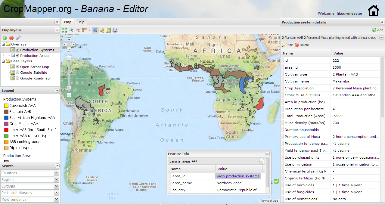
The aim of the project was to develop a GIS tool that makes spatial information on global banana production accessible through the internet. The ‘Banana Mapper’ makes it possible for anonymous users to view and download the data and gives banana experts the GIS functionality that is necessary to validate and enhance the database. No desktop GIS-program is needed, only a simple web browser. The tool was build combining open source software (such as PostGreSQL, PostGIS, GeoExt, OpenLayers, GeoServer) and was written in javascript and php. Check it yourself at: by visiting www.crop-mapper.org